The Sustainable Research & Development of Dokdo


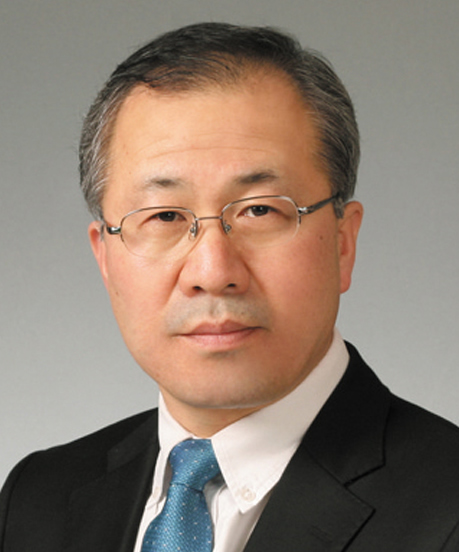
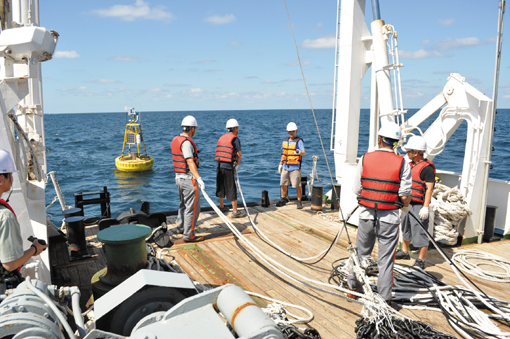
 (L)By Park Chan-hong, Director General of the East Sea Research Institute/Chief of the Dokdo Research Center, the Korea Ocean Research & Development Institute (KORDI). (R)The Korea Ocean Research & Development Institute (KORDI) has played leading roles in multidisciplinary studies of Dokdo and has secure such all infrastructure for studying the island as research manpower and equipment, including a maritime science survey ship (seen on the top photo).
Dokdo, 216.8 km away from Jugbyeon-myeon, Uljin-gun, Gyeongsangbuk-do, which rose from the seabed of the East Sea 4.6 million years ago, is a part of the national territory we have cherished and have to protect with concern for all the Korean people due to a territorial dispute with Japan. The island, located at the center of the East Sea, boasts of all sea structures and marine characteristics from coastal areas to deep-sea from a marine science perspective. Dokdo has a value greater than the island itself, which measures 187,557 square meters in size.
Historically, Dokdo is not only the Republic of Korea’s territory, but also an undisputed territory over which Korea exercises its territorial rights according to international law. But Japan, which seized it by force in the course of invading the Korean Peninsula in the early 1900s, still claims territorial rights over the island and has spread its assertions over the naming of the East Sea until recently. In particular, Japan has intensified its response regime by enforcing the Basic Act on the Ocean in July 2007 and activated the comprehensive marine policy headquarters while having shifted into high gear over its territorial rights by publishing middle school study guide books as well as elementary and middle school social textbooks classifying Dokdo as Japan’s territory.
Against this backdrop, recognizing a shortage of basic information about the management of Dokdo, Korea enacted the Act on the Sustainable Use of Dokdo in May 2005 with the goal of grasping exactly the territorial value of the island and establishing new polices to protect it. The purpose of the law is to establish ways of protecting the ecosystem of Dokdo and its surrounding areas and rationalizing the management and use of marine and fisheries resources. The Basic Plan for the Sustainable Use of Dokdo, which was established according to the law, is a legal foundation for current and future use of the island and is now being implemented. In this regard, a comprehensive marine science study of Dokdo is underway.

 The Dokdo Research Center's second phase project is about the execution of studies on Ullung Island-Dokdo connectivity and the monitoring of the erosion of the island as well as the continuous provision of the useful information about the island.
Recognizing the fact that KORDI has played leading roles in multidisciplinary studies of Dokdo and has secured all such infrastructure for studying the island as research manpower and research equipment, it was designated as a specialized institute for studying the island in 2006 in accordance with the Act on the Sustainable Use of Dokdo, Article 9 and its implementation decree, Article 9. In this regard, the Dokdo Research Center has implemented a project to study the sustainable use of the island since its establishment in 2006. The project consists of the first phase of basic study, the second phase, which entails more in-depth study and the third phase, a utilization study. The five-year first phase that began in 2006 ended this February, and the second phase study is to begin this May.
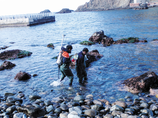
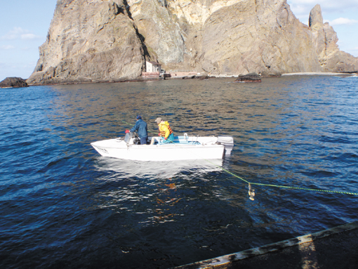
The Dokdo Research Center’s execution of the project has led to a detailed understanding of what Dokdo looks like, including the structural features of Dokdo’s seabed and coastal areas, and the accumulating of data as well as the establishing of a foundation for the future sustainable use of the island by carrying out projects to monitor environmental and ecological effects prior to and after the use and development of the island. In particular, the five-year first phase of project brought precision undersea map data through multi-beam echo-sunders plus continuous wide-area monitoring of the maritime environment and the drawing of an underwater ecology map that can grasp the ecological diversity and ecological features by monitoring the ecology of the island’s coastal areas. The research outcomes were obtained by sending the maritime science survey ship carrying researchers and research equipment to the island and its surrounding area each season and conducting more than 50 benchmark soil surveys, which required the mobilization of some 100 researchers annually.
The upcoming second phase of the project is about the execution of studies on Ulleung Island-Dokdo connectivity to step up the island’s territoriality and the monitoring of the erosion of the island as well as the continuous provision of useful information about the island by building a comprehensive maritime observation system and a real-time information service system. nw
Photos on courtesy of KORDI
3Fl, 292-47, Shindang 6-dong, Chung-gu, Seoul, Korea 100-456
Tel : 82-2-2235-6114 / Fax : 82-2-2235-0799